| photos : GPS tracks
Intro
We made two mountainbiking visits to Corsica in the last fortnights of September 2017 and 2018. On our previous visit with mtbs to the south of the island we had not been successful in finding interesting routes, and we had not been optimistic in 2017. We love Corsica for its road riding, and went with the expectation that any mtb-ing would be a bonus. In 2017 we booked accommodation before finding out much about routes – one week in the Castagniccia which is an area we adore, then a week in Urtaca in the Ostriconi valley as the nearby Désert des Agriates looked promising. Both houses had pools; this influenced our choice. In 2018 we spent a week at Sisco in Cap Corse (again with a pool) and another in the same house as previously at Urtaca.
Corsica is very popular as a French holiday island and some areas have a lot of waymarked footpaths. The IGN 1:25K maps show paths and tracks comprehensively, but it is a gamble as to whether any given path is still in existence, let alone passable. One has more confidence in paths that are waymarked but even they are not 100% reliable. We found some damage to paths from the heavy rains in autumn 2016. Corsica is mountainous and rocky and there are some very challenging routes that would be way beyond the capabilities of the average mtb-er. Our research involved watching a fearsome Youtube video of three rather tough guys taking bikes on a section of the Mare a Mare route, mainly carrying. This looked a little much for us.
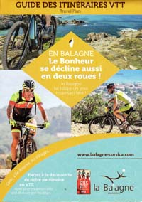
The Castagniccia Mare e Monti VTT club has an area on the FFC site. We saw it prior to our 2017 visit, but it wasn’t as much help as we’d hoped. Intensive web searching while out there revealed quite a few good routes on Wikiloc and some French VTT sites. Google maps from google.fr have a lot more paths marked than the UK version, presumably using the IGN data.
 |
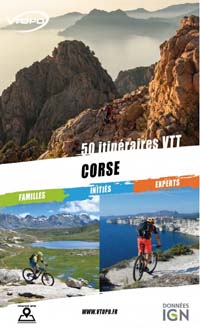 |
Also the publisher Vtopo has issued a book of mountainbike rides for the whole of Corsica. This contains useful maps and information (in French). Unfortunately you have to pay extra for the GPS tracks, and if you pick the book up in a bike shop you don’t have the option of getting the tracks more cheaply as a package.
If we go back to the south, we may try some of the routes shown on the Valincu Taravu Team website.
The weather was perfect for both visits. We had a couple of cloudy afternoons and some late rain during our first visit but otherwise it was sunny and warm. In September many restaurants outside the main towns are shut for the season. L’Île Rousse is reliable for pizzas, fridge magnets, noise etc. There are red kites (milans royaux) galore in Balagne.
The granite terrain leads to the presence of lots of rocky sections along the paths which provide interesting (and sometimes difficult) technical challenges, usually gratifyingly unaccompanied by any element of exposure.
A local hazard is the luzerne des sables, a low-growing rock plant whose burrs incorporate a tyre-penetrating spike.
Castagniccia (2017)
Castagniccia is a forested area full of little roads and villages. There is a big N-S ridge headed by Monte San Petrone. We stayed near San Lorenzo on the west side of the ridge. The east side is a little more touristy and has more waymarked paths, restaurants and shops.
We would have been happy enough simply road riding – the terrain is interesting, the villages fairytale picturesque but very authentic and unprettified, the roads are as narrow as cart tracks and very quiet. The more pleasurable the cycling, the more terrifying the driving and we found excuses not to use the car. As expected we ended up with a lot of road riding, investigating off-road options here and there, and by the end of the week we were finding more; if we had known more in advance we could have done better rides.
Romanesque chapel |
A more extensive route can be made from linking two rides we did near Bustanico and Sermano. From the Sant Antone pass there is a decent gravel road leading to the chapel of Sant Antone and from here a rougher rubbly track descends towards the south. There are panoramic views of the central mountains around Corte and shrubbery all around featuring wild roses. At the road, turn left for a little way and then pick up a footpath heading down to Sermano. This doubled as a stream bed and we did not ride much. The path continues down through the lanes of Sermano to doubletrack leading to San Nicolao chapel, where we turned right on the Mare a Mare which was a bouldery push or occasional carry for a stretch before becoming rideable singletrack where you have to pick the line carefully as the traditional route is overgrown and the walking path takes detours.
The path reaches a dirt road. The route continues following the Mare a Mare Nord Variante leading southwest over the Bocca di Boziu and this is brilliant. It starts off a little difficult. The way follows an old path between walls that has a lot of small boulders making for tiresome riding but people have made detours - first on the dirt track to the right, then crossing over where this runs out in a clearing, and then following an informal path to the left of the walled path. After the pass you rejoin the old path and the fun starts. There are flowing sections interspersed with sustained runs of steppy obstacles and it keeps this up this standard pretty well the whole 4km. It is a ridge and the views are extensive. Midway through where you go past a small barn, the gradient and rocks ease off for a spell before the fun picks up again.
We tried sections of the Mare a Mare from Mazzola to Bustanico, pointlessly. But the roads are nice.
On the eastern side of San Petrone we explored paths between villages with mixed results. There is a cluster of three FFC rides in the area. We downloaded an old version of the FFC Croce-Polveroso route and tried to follow this, with only partial success. The San Cristoforo – Polveroso path is steep and interesting The start of the path from Polveroso to Ponte Bianco was weirdly hard to find given we had GPS – there are a lot of paths starting from Polveroso. It was a rough path in woods with some weather damage. The main obstacle in these parts is dangly roses and brambles. You are concentrating on manoeuvreing your bike over some tricky root below when you find yourself inescapably destined for a bloody encounter with the vegetation and the vegetation is going to win. The GPS track alleges there is a way through from the bottom of this to the lower end of a track up to Ficaja. This would involve crossing what looked to be a decent sized river unprovisioned with a bridge. We looked around for a crossing after we had joined the road but just got shouted at by a logger. So we just went up the road. How to join the tracks was a mystery we never satisfactorarily solved. Happily we did find a restaurant open in la Porta, which did pizzas. For information, a Belgian pizza is one with chips on.
Stoppia Nova |
Croce is an FFC centre which means there is a poster of information about routes in the village hall. We saw there are plans for a Croce-Moltifao traverse route. We had seen VTT signs at the Col de Prato leading south along the ridge path which for a while is a dirt road; we had folllowed them. The signs then direct you left onto a track to the ruined chapel San Petru d’Accia, but here the signage stopped. The track continued south but it was only marked as a path on the map and though tempted, we did not want to risk wasting time on something that might not work out. Out from Croce, at the junction with the D71m, we found VTT signposts at the other end of this path. We surmise that this is perfectly feasible as a through route. We think that the contination to Morosaglia from the Col de Prato goes north up the ridge to the Bocca di Pruno and down some track – Google maps seemed to show a plausible route. Next time, we will find out for sure.
Ostriconi (2017, 2018)
From Urtaca we mostly did rides in the Balagne and found the routes are consistently good. The roads were less terrifying and we used the car. There is a shopping precinct near Losari with a convenient car park, a supermarket, some sort of bike shop, a shop selling beach towels and fridge magnets and IGN maps should you happen to have forgotten to bring your map, and importantly a glacier.
We found a good long ridge ride – Rumbicina – which we started and finished at Urtaca, and which turned out to take longer than we expected. We took some cake but not enough. First all on road and a lot of up to Bocca di u Prunu, then back along the the dirt / gravel road along the ridge - this involved more up, and some pushing. From the summit there there are very good views of the jagged spine of the island. Continue E to Bocca a Croce, cross the road, then up to Bocca di a Fuata Dura, which is straightforward to follow. The final section is to follow the ridge SE on the Coteau de Rumbicina. Although the footpath had been signposted at the road, there isn’t any guidance later. There are dirt tracks going in the right direction but we were never quite sure which fork was right as there are alternatives. If in doubt the most credible road is correct.
The doubletrack ends at a clear spot with an shapely tree and the way continues as a singletrack path to the right of the tree and a hillock – the path is well defined and clear, even if not signposted. It is an excellent flowing path with some obstacles and the hillside is very attractive with colourful shrubs. At some point it crosses to the other side of the local ridge and around here we got quite lost, following a cow path up to a dead end, with a very steep pathless slope ahead. We carefully consulted the GPS and map, realised we were too high, backtracked and eventually found the right path. This did become precitpitous for a long stretch and we played it safe (ie, pushed quite a bit). There are good views over to Urtaca and Lama. It eases off towards the end and joins a track. Here we followed the most obvious track, which was wrong. We should have continued to the hamlet of Pedanu but instead followed track to road where I fell off. There is a very good café-patisserie in the layby on the main road at Pietrabla. Make full use of it. Don’t do what we did and ride straight to Urtaca.
Having realised, and regretted, our omission of the café-pâtissere we made it the destination of the next day’s excursion. There is a singletrack Lama–Urtaca path and it is brilliant, 2 km packed with bouldery fun. It is easier in the downhill Lama-Urtaca direction.
The Désert des Agriates ride became something of an epic. We downloaded what looked like a suitable GPS route from Wikiloc that made a natural loop, taking in some of the coastal path. We had remembered this time that we should take sufficient cake, but forgot to actually pack it. We bought bananas and bread at the fruit shop on the main road and packed the bananas in my helmet inside my pannier. The ride is road to start, at moderate gradient. At the pass, a turn onto a long rubble piste to the beach; a short climb then long descent. The desert is not what you might picture as desert, being shrubbery exactly like most of the rest of the island. The piste is easily manageable on a mountain bike but difficult in a four-wheeled vehicle as sometimes one vehicle wheel rut was alarmingly higher than the other wheel rut; we gleefully passed a car on the way down. We sat on a randomly chosen beach and made sandwiches with the bread and banana pulp. I washed the remaining banana pulp from pannier and helmet in the sea. We explored the beaches and nosed around the gîte d’étape – a cluster of cute thatched huts.
The best section now followed the coast path south, a little bit of a carry up rocks, then after that all rideable, and a very beautiful ride close to the sea. At the next cove, where we saw a snake, we were supposed to head inland on a chemin d’exploitation, but the only signposted route was a footpath that fun to start very gradually became unrideable and very very gradually veered away from the GPS track so we were never convinced we were going the wrong way until well into the detour.
Overgrown path | Fence at Luogu Pianu |
The Vtopo guide contains a shorter – but equally enjoyable – route: Acciolu.
Balagne (2017, 2018)
The Balagne was the big discovery, some of the best mtb-ing of anywhere we have been. In 2017 we planned our routes based on Wikiloc information; it is a good resource and usefully you will find that some routes you might have been tempted to try are disrecommended. In 2018 we had the FFC info in addition.
Palasca-Cento Chiave. This did not have FFC waymarks when we rode it (in fact it is part of balade no.3). As makes sense, you ride up to the village on the tarmac and down the roughstuff. The ridge roughstuff is mostly straightforward double track, a little rubbly and loose at times. Lots of low-flying red kites here. The descent from Cento Chiave is fairly technical, a lot of the challenge being rubblyness. There are some nice sharp zigzags.
Santa Reparata. There is a lot of good riding in the vicinity of this village; you can divide it up into routes in different ways, and we covered much of the same ground in different rides during our two visits. We recommend the 3 routes on our GPS page.
The route we call ‘Santa Reparata’ uses some sections of FFC Balade no. 4. It begins with a tarmac climb to San Francisco, then singletrack over to Sta Reparata which has boulders and an amenable gradient; the granite rock is nice and grippy except where it has become sand.
From this village we left the FFC balade no.4 and took the route down to Lac de Codole. It is tricky to find because it is not well signposted but you basically turn sharp left before the houses and head down. This was even more technical with lots of sustained runs of varied granite obstacles. Be aware that when you reach what feels like the bottom there are still more obstacles, so keep your hard hats on.
The route ends with easy piste back to Tesa.
Refermez la porte SVP |
Occhiatana steps |
The Codole route is an extended and improved version of FFC balade 12. We started at Losari but you could save some road riding by starting at Tesa. Here you leave the road, joining a path made up of nice singletrack with some gates that stretch the definition of gate (e.g. an old bed). These do slow you down, with the laborious process of opening the gate, trying to hold it upright in place, dragging it back, working out where the bent coat hanger goes in order to secure it, laughing at gate, photographing gate to show disbelieving friends that such a preposterous thing could exist.
After crossing the railway line we followed the path over the Bocca di Casa Oleca – some nice little testing sections but also great big rocky lumps we couldn’t ride. Near Monticello we climbed a steep rubbly piste, part of which we gave up on, which turns to road as it approaches the village. From Monticello the route climbs to San Francisco and down the descent used by route 12. It is a boring double track to start but becomes an interesting single track, some sections of which were beyond us. We much prefer the descent from Santa Reparata. We rode up to Santa Reparata on the road and continued up through Alzia which has a cute church, and followed the path past the convent ruins. The ruins aren’t all that exciting but the views down to the coast are good and the singletrack has some charming obstacles.
After Occiglione the track starts nice but becomes harder as it steepens. After meeting the track from Sant Antonio we crossed the road onto lovely flowing singletrack that meets a piste which turns into a brilliant extended run of obstacles all the way to l’Île Rousse.
After stuffing ourselves with pizza and marvelling at some large ferries, we followed the route of FFC balade 4. This was a nice (and rather convoluted) way of getting out of town, including a tricky uphill section. It led us back to a repeat of our morning’s climb to Monticello, which we greeted with no more enthusiasm than previously. Finally came the descent to Tesa, which is all brilliant.
Goats | Beignets |
FFC balade number 10 goes to Olmi-Cappella. We thought that to make it worthwhile we’d climb on the road from Losari and bung in a bit of balade 9 for good measure. It was a good (and strenuous) day, but the mountain-biking was disappointing. The descent into Olmi-Cappella was very average, and the piste traverse of Mt Tornabue had an awful surface (though the views were good). Beignets and pizza at Olmi-Cappella.
We reckied a route near Corbara, but it was a waste of time.
Cap Corse (2018)
We stayed at Sisco, which is a pleasant green valley a little north of Bastia’s urban sprawl. The riding is less technical here than in the Balagne, but there are routes – Sentier des douaniers, Col de St Jean, Arcaja – which are scenic and satisfying. There is some technical fun to be had in the paths connecting hamlets in the Sisco valley, and there are some entertaining mountainbike tracks inland from Macinaggio.
GPS tracks
index : Acciolu : Agriates : Arcaja : Assalaccia : Centu Chiavi : Codole : Corbara : Douaniers : Lama-Urtaca : Olmi-Cappella : Piazza : Rumbicina : S Giuvanni : San Quilico : Sta Reparata : Stoppia Nova : Tuani : Turrezza+Crosci : oreta : polveroso : sernano
| photos : GPS tracks