| narrative : photos : illustrated map
General Info
We’d consulted several guide books before our visit, and also read Ivan Viehoff’s trip notes [dead link].
Guatemalan towns have long names often based on indigenous words. Be warned that ‘Xela’ abbreviates ‘Quetzaltenango’. The letter x is pronounced like the English sh.
We didn’t take a tent, and there were always places to stay a day’s ride apart. But if the hotel at Sacapulas had been shut or full we’d have had difficulties.
There are enough places to eat. Basic restaurants serving the locals are ‘comedors’. One thing we never sussed out about Guatemalan eating was the unadvertised soup course which occasionally arrived when we weren’t expecting it.
Guatemalans are not connoisseurs of tranquillity. Désoeuvré youths spend their time igniting firecrackers. Unsilenced buses trundle the streets blaring their horns. Hotels which would otherwise be attractive are often in noisy locations, so choose with care.
We have some statistics on our ride on the ride stats page.
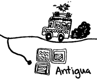
Guatemala City
We’d been warned about Guate: dangerous and nasty, they said. We gave it a miss. Before flying out we’d booked ourselves into a hotel at Antigua, and the hotel were more than happy to arrange a minibus to meet us at the airport. We’d probably have had no trouble in sorting out our own transport.
Antigua
 |
Antigua – Chichicastenango (1950m): 115 km, 1700m of ascent
This is a hard ride and not especially pleasant. The only real reason to do it (rather than, say, catching a bus to Chichi) is that it’s good training for the even harder ride from Pana to Xela.
The first 18 km to Chimaltenango are quite enjoyable, but Chimaltenango is an ugly road town and the traffic now becomes quite heavy. The drivers are particularly maniacal on the straight bits of road, and it’s best to use the shoulder where possible.
Tecpán, at almost exactly half way, has restaurants where you can be deafened by marimbas and fattened by oversized portions. There are also hotels here.
After Tecpán the scenery becomes attractive and the road, which is beautifully engineered, becomes quieter. Interminable climbs take you to a high point of 2610m, after which you drop down to Los Encuentros, another ugly road town.
The road onwards to Chichi drops steadily then plummets into a valley. The climb out is a cruel end to the day: 200m are gained at 1:6. Finally you descend into Chichi itself. The Maya Inn, though expensive, is a lovely old colonial building.
Chichi – Panajachel (1530m): 40 km, 700m of ascent
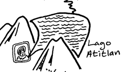 |
We indulged our bikes with a rest day, taking a boat tour of the lake.
Pana – Xela (2300m): 92 km, 1950m of ascent
El día de la veridad. The 850m ascent from Pana sucks all the strength from your legs. Take the views as a pretext for frequent rests.
There are shops and comedors as you join the PanAm. The road undulates gently and is fairly quiet. You come across a couple more comedors near the junction to Sta. Clara del Lago, but no more until Cuatro Caminos. So don’t make the same mistake as we did and pass these ones by.
The road, well graded and pleasant, climbs in earnest after Nahualá. Eventually you reach the bleak Altos de Alaska (which are more likely to remind you of Wales) at 2850m. From here a giddy descent gives superb views of the volcanoes around Xela until the road surface instantly degenerates as you enter Cuatro Caminos, another spectacularly ugly road town.
The remaining 11 km to Xela are flat, atrociously surfaced, busy, and dangerous. Not the sort of road you want to ride twice.
The outskirts of Xela are equally unpleasant, but the centre isn’t too bad and the Pensión Bonifaz is a comfortable place to stay. The staff let you carry your bikes upstairs while the other guests look on horror-struck.
Day Ride from Xela
We took a pleasant ride through Almolonga and Zunil to Fuentes Georginas, where there are open-air thermal baths (don’t forget your swimming costumes). A couple of km after Zunil youmeet the main road, where you must turn left (uphill), and then right onto a signposted minor road not long after.
This was meant as a rest day, but we did almost 1000m of climbing (as usual), partly due to taking the wrong turning just after Zunil.
Xela – Huehuetenango (1800m): 99 km, 1570m of ascent
Today we took a detour from the PanAm. The Rough Guide describes an old road to Huehue via San Carlos Sijá. You will need to get directions before setting out, but the road isn’t hard to find. It drops to a valley near Olintepeque, then climbs to a pass at 2600m. From here it undulates gently to San Carlos.
The Rough Guide promises beautiful views, but the weather had turned sour on us and we saw nothing but clag.
The tarmac gives out at San Carlos and is replaced by a heart-breakingly bumpy dirt track (not all as bad as the first stretch). If you pick your way through it you reach Pologuá on the PanAm after 9.5 km. Turn right at the first fork; bear right at a crossroads 5 km later. There are several more junctions, all unsignposted, so ask the way as often as you can.
The high point is 2755m, after which you drop to Pologuá at 2650m. There are several comedors here, and a few later on the road.
From Pologuá there is an undulating descent through lovely scenery to 1650m. The surface is poor where it hasn’t been replaced. A final well graded climb takes you to Huehue.
We didn’t find any hotel we really liked at Huehue, but we treated our bikes to another rest day. As we sat reading in the courtyard of the Zacaleu we felt the ground wobble beneath us. We were on the edge of an earthquake in El Salvador which killed many hundreds.
Huehue – Todos Santos (2340m): 46 km, 1600m of ascent
A monster climb of 1400m on a south-facing slope. The road rises gently for the 5 km to Chiantla, then becomes viciously steep (1:10). The first pass is at 3050m, and just before it is a mirador which is worth the sidetrip. Behind the pass is bleak pastureland with scattered houses. Near Paquix village there are a couple of comedors.
After a while you come to a fork at asmall village where you turn left and the tarmac ends. Climb gently on a dirt track to a pass at 3260m, then drop 920m in 11 km down an attractive valley. In the heroic ages people made this descent clinging desperately to drop handlebars, but today’s degenerate breed of cyclists takes the soft option on mountain bikes.
As we rolled into the village, a lady from one of the language schools greeted us and said that in the 3 months she’d been welcoming arrivals no one else had come by bicycle. We stayed at the Hotelito Todos Santos, which was bearable, and ate at the restaurant formerly known as Ixcanac.
You can buy Snickers at Todos Santos – a sure sign of gringo infiltration – and they may motivate or power you on tomorrow’s climb.
Todos Santos – Huehue: 46 km, 1000m of ascent
The climb back out is only just rideable. Now that you’re reduced to crawling pace the dogs aren’t above exploiting your vulnerability. But the descent to Huehue is a pure delight, all too brief in its 30 minutes.
Huehue – Sacapulas (1150m): 62 km, 870m of ascent
Now begins a 5 day odyssey on unsurfaced roads. You could shorten it by riding straight from Sacapulas to Uspantán, or by spending only 1 night at Nebaj, but this is the best cycling of the trip, so in spite of the reduced level of comfort it would be a shame to cut it short. The rides are hard but not unduly long.
Head from Huehue to Chiantla, and after 4 km turn right onto a fair track. After a further 5 km is a fork, both legs of which are signposted to Aguacatán. Following Ivan’s advice we took the left one. Climb gently to 2050m, then drop to Aguacatán (26 km from Huehue, 1630m). If you resisted the temptation to make an early start from Huehue you will arrive at a reasonable time for lunch. There are no more comedors until Sacapulas.
Aguacatán is quite a large town with a whiff of onions in the air. The women wear beautiful white huipiles embroidered with bright flowers.
Drop a further 40m to a river, then climb to an undulating plateau at around 1800m. The road here is very sandy and washboardy. There are a few scattered shops and villages, the largest of which is Llano de Coyote.
40 km from Huehue begins a steep descent to a bridge 10 km further on (1150m). A further 12 km of undulating road take you to Sacapulas. There are comedors by the bridge but only one hotel, the Rio Negro, which is very basic. The panaderia by the main square is good, however, and this is the low point for creature comfort.
Sacapulas – Nebaj (1870m): 34 km, 1520m of ascent
You can see the road from Sacapulas cutting a diagonal up the hillside into the distance. It’s a vicious climb redeemed by lovely views of forested ridges. The junction occurs after 13 km at 2040m. The road continues to climb steeply for another 4 km, and then drops slightly to a village which, in spite of the maps, insists on calling itself Media Luna (2350m). There are comedors here.
The valley is lush and lovely, with patchwork fields and signs recording foreign aid (including British). The road undulates gently past villages and shops, then pulls itself together for a final gentle climb to a pass (2500m). There are beautiful views onto Nebaj below, set in a green hilly basin. Drop steeply to the town and let your wrists and shoulders recover.
 |
The women wear red skirts and huipileswith brightly coloured zigzags, and tie their hair with pompom headscarves. The men wear jeans and American fun-run teeshirts, showing clothes recycling to be an ethnological crime. But one can’t help loving a people whose women dress so beautifully.
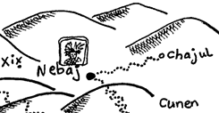
Nebaj – Chajul – Nebaj: 45 km, 1050m of ascent
We thought to give ourselves an easy day by riding to Chajul and back. The road undulates with a high point (2050m) at a pass 10 km from Nebaj. The climb to the pass is steep on the Nebaj side. The countryside is hilly and lovely, with plenty of shops, villages, and pigs along the way. Locals mostly ignore you as you ride, but some wave.
Chajul is a pleasant town of adobe houses and tiled roofs, smelling of woodsmoke. Women wear bright red skirts and vibrant huipiles for which blue seems to be the new fashion. You will probably be accosted by friendly girls wanting to sell you weaving. We succumbed and had no regrets.
Nebaj – Uspantán (1750m): 50 km, 1425m of ascent
Climb steeply back to the pass, then drop gently to the junction. A further 5 km take you to Cunén (26 km from Nebaj, 1780m). If you didn’t start out too early you can have lunch at one of the basic comedors here.
Now descend – first gently, then steeply – to a bridge (32 km from Nebaj, 1535m); contour round a little, and embark on a long climb which begins steep and eases off around the village of La Hacienda, eventually reaching a pass (40 km from Nebaj, 1920m). An undulating descent takes you to your destination.
Not much traditional dress is worn at Uspantán, though there’s topiary which might come from a run-down stately home. The place to stay is the Hotel Casa Blanca, which has new beds and a friendly proprietress, although it suffers from dog noise. The place to eat is the romantically named Comedor Kevin, with leathery steaks and deflated ‘Feliz Navidad’ balloons. A poster describes 5 ways to cope with cold and rain.
The next day we woke to find Uspantán cold and wet.
Uspantán – Cobán (1280m): 85 km, 1500m of ascent
A long ride which for us became a 9 hour epic. Drizzle turned to rain; the road oozed mud; Colin’s chain fouled up; Tracey’s cleats fouled up. It took 2 hours to clean the bikes the next day.
The road from Uspantán climbs a small ridge and then descends continuously to the bridge at Chixoy. The only village on the way is Chicamán (10 km from Uspantán, 1345m). The surface for the descent is remarkably good.
The valley here is thickly forested but sparsely populated. After the bridge comes a long climb. The road is now very bumpy, and the only traffic is lorries struggling against the gradient. The passengers cheered us as they passed.
The first village is reached 39 km from Uspantán at 980m (so the average gradient from the bridge is about 1:14). The road now undulates, gaining height slowly until at last it reaches a shoulder (56 km from Uspantán, 1410m). From here it descends, reaching tarmac at San Cristóbal (61 km from Uspantán, 1315m). The rest of the ride is undulating and a little busy, but it’s tarmac so who cares?
No More Cycle Touring!
Cobán has a nice hotel, plentiful good food, coffee, cake, wine ... everything a weary cycle tourist craves. We spent a day there and loaded our bikes onto the express bus to Guatemala city, where we swapped to a chicken bus back to Antigua.
Antigua is even more sybaritical. From there we made a trip of a couple of days to Tikal by plane, spending a day at the delightful town of Flores. Back at Antigua again we took self-indulgence to a new pitch, spending a night at the beautiful colonial Casa de los Cántaros. Then we flew back to England.
CJC. 2001
[According to Steve and Ann Gregson [dead link] the road from Huehue to Cobán is being tarmacked, and the work will be complete by the end of 2004.]
| narrative : photos : illustrated map