| yamunotri route notes | gangotri→
The
 |
There are roads that go all or most of the way to each temple. The three rivers that join to become the Ganges all rise in the same massif, and as the crow flies, they are not all that far apart. But they are separated by high mountains, and the passes cross extensive snowfields and glaciers at nearly 6000m, which, for a cycle tour, we were inclined to draw the line at. Instead we would have to go up and down each valley, connecting them via the more modest road passes of only 2500m or so. This may not sound much, and though we never quite made it above 4000m, our ascent totalled 25 vertical kilometres.
Relatively few westerners visit the area. There is not the same trekkking infrastructure as there is in Nepal, and consequently Garhwal, to us, feels very unspoilt, compared with, say, the Annapurna round, with its teahouses serving pizza, apple pie, and beer.
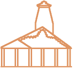
Shrine at Gaurikund |
To do the Char Dham thing properly, you are supposed to start the pilgrimage at one of the holy cities on the Ganges, such as Haridwar or Rishikesh. We started from the more comfy option of the former British hillstation of Mussoorie, and the delightful verandahs of the Padmini Nivas hotel. We were in for a month of hotels catering for Indian pilgrims, which we suspected might be more than a little grim.
Mussoorie is in a grand position, 2000m high on a ridge right above Dehra Dun. We had hoped for enticing views of the snowy mountains ahead of us, but the monsoon was late to clear, and there was just haze and cloud. We dropped down from Mussoorie to meet the Yamuna river, and over two days, rode up the valley to the roadhead at Janki Chatti. The Yamuna springs from the slopes of the Bandarpunch mountain, and our first stunning, inspiring view, was from just beyond Barkot on our second day. The Yamuna was the first of many lovely valleys. At first it is wide and the slopes are terraced into luminous green rice paddies; then higher up, the valley narrows and steepens, the slopes mainly forested, but with flashes of crimson and orange of amaranth terraces.
If I am to give an accurate account to this trip it will quickly become apparent that this was not the best-prepared tour that we have ever done. Our increase in experience of this sort of travel is just about counterbalanced by our increasing laziness in planning. Our only estimate of distances had been from a sketch map in the Thukrals’ book and we had guessed that four weeks was probably more than ample time, and would allow us plenty of days to spend loafing in warm places in the sunshine. As for preparing the bikes, I had gone so far as to replace the chains, but thought the sprockets would do as they were; at least from a choice of eight, Colin ought to find one or two that were useable.
And you might think that with three altimeters between us would have been more than enough, but we had only been riding three days before we lost the use of the VDO. The top of the transmitter bounced off on one of the billion lumps of Garhwal’s roads a couple of hours from Barkot and we spent an hour hunting for a 1cm piece of black plastic, unsurprisingly fruitlessly.
We rolled hungrily into Syanachatti to find the dhabas packed up for lunch. Our morale continued to sink beyond Syanachatti, as the road worsened, and we had not even reached the last 7km, which was said to be only practicable by 4wd. By the time we came to that entertaining stretch, we were well into the thick of the mountains, the valley steep-sided, the scenery glorious, but we were reduced to walking pace, and this fact was made horribly clear to us by a young chap who had no trouble keeping up with us on foot.
The road,
Yamunotri trail | Yamunotri |
The walk to the temple climbs this valley. It is a well made path that climbs steeply, often in zigzags, and there is a terrific section traversing a vertical cliff, the pathway built out with twigs. Yamunotri is a small cluster of buildings by the river, in a place where there are hot springs. Leading to the temple is a little lane of smoky plank-and-tarp dhabas and colourful stalls selling bright icons, bangles, and red and gold temple offerings. Of the Char Dham, Yamunotri is the least visited, and despite this, and despite it being the end of the yatra season, there were stacks of people on the path. And all sorts of people. Sadhus and pilgrims, young trekkers carrying camping gear, families, dignified elderly men, and women in beautiful saris.
On our return to Janki Chatti, we crossed the river to Karsali, where there is one of the oldest temples of the region. The village itself is an absolute treat: traditional wooden houses with slate roofs, some painted bright colours and others with elaborate carvings, and a genuine friendliness from the locals as we walked through. Although this is on the yatra trail, they cannot get that many tourists in here, and certainly very few of those curious westerners. As we approched the temple, we had attracted a crowd of delighted small boys. The old temple itself does not look much from the outside – a plain and squarish three-storey stone tower, more fortress than temple. Inside it was pitch black. Ladders made from logs, polished smooth by countless years-worth of feet lead up through narrow gaps, the tiny hands of the boys helping us up in the darkness. Rooms of warped and age-blackened beams lead off from the central staircase, all empty save for one shrine on the top floor.
Kharsali |
We returned to Barkot in the afternoon. The highs of the morning were followed by a low night. A fairly rowdy group of pilgrims were staying at the same hotel, shouting until well after midnight, and then again at 4:30am. They said they had to get up for an early start, but they had only just started breakfast at 7:30. We abandoned all hope of procuring breakfast for ourselves, even though we had a 1000m climb to face.
Despite all this, things began to look up again, because it was a beautiful climb, a narrow road winding gracefully upwards through wonderful forests, virtually no traffic, and views to the snow peaks. It was so enjoyable that we barely noticed that we had gone through half a dozen reincarnations as toiling cyclists (ok, about 3 hours) before the once infinite valley sides were revealed to be in possession of tops and that the road was quite close to them. The pass, a place called Rarighati, satisfied the minimum standard for such things in that it had a summit tea shop. We admit we would have preferred that it had served breakfast, but nonetheless it was not a bad tea stop, the chai-wala having made an outside table from a cable drum, painted green, and decorated it with flowers in jars and beakers.
We found breakfast a little way down the other side where there was a handful of dhabas serving the bus traffic. Breakfast in these parts is aloo parantha – a flour dough wrapped around grated or mashed potato, rolled flat, then fried, and served with pickle or curd. Beats muesli. The dhaba family’s two youngest played a cricket match in the middle of the road, using a twig and rolled-up crisp packet.
At some stage I should say something about the food, but in truth, there is not very much to say. Lunch and dinner are invariably dhal, vegetables, chappatis and rice. As befits a holy Hindu land, there is no non-vegetarian food, and there is no alcohol. What there is to drink is chai – tea boiled up with milk and sugar, and often spiced. We did rather get a taste for it. The meals were fairly monotonous, but it was decent enough stuff, and since we were permanently ravenous it was impossible not to have an appetite for it. There were simple pleasures. Chappatis fresh from the fire, some with embedded with still-burning coals, were always deliciously toasty. Occasionally there was some variety in the vegetables – fresh okra was good, and the smoky brinjal we found up at Kedarnath was a memorable highlight. Sometimes we found gulab jamun –the most divinely delicious substance in the known universe.
But back to the ride. The valley the other side of the pass was more given over to terracing than the side we had climbed, and led down towards the Bhagirati, the first of the Ganges source rivers, and the one that is held to be the ‘true’ Ganges though we don’t know why, because the Alaknanda is bigger. It was a trifle disappointing for our first view of the holy Ganges valley to have a thing resembling an oil refinery planted smack in the middle, but our road swung left and up over a bluff, and we were spared any further sight of this blot. The road up to Uttarkashi was relatively busy, and a bit of a chore to ride, but over quickly. After Uttarkashi (and a desperately late lunch), it is more quiet and we had a pleasant enough stop at Netali.