[This page was written after our 2006 visit to the Huascarán area, and updated 5 years later after our trip to L. Safuna.]
| Guidebooks and maps | Altitudes | Accommodation | Camping | Food and drink | ||||
| Security | When to go | Acclimatisation | Roads |
Guidebooks and maps
We got most of our information from the Footprint guide which has unfortunately slimmed down since our last visit. [2011: you can now buy electronic copies of individual chapters, which is strongly recommended though we found that we needed to chase after every purchase by email.]
There is an abundance of maps.
 |
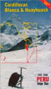 |
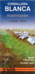
Slightly better for most purposes are the two sheets Cordillera Blanca Nord and Süd also at 1:100000 published by the Austrian Alpine Club in the Alpenvereinskarte series. These are based on the IGN series but with corrections. They are very attractive and the two sheets follow the alignment of the Cordillera while the IGN maps are based on arbitrary grid quadrangles.
Lima 2000 produce a schematic map of the Cordillera Blanca. The lack of detail makes it useful for an overview, but otherwise it is no rival to the topo maps.
The maps mentioned above can be obtained by mail order from specialist suppliers in the US and Europe. Another schematic map, this time with relief colouring, is published by Felipe Diaz. It is commonly used for display purposes in the area, but can only be bought locally. [2011: Sr. Diaz is proprietor of El Abuelo restaurant and hostel in Carhuaz, and is both friendly and helpful.]
Both schematic maps provide some information on road distances. Unfortunately this information is completely unreliable. You’re better off measuring with your thumb on the topo maps.
The best soft copy maps known to me are on andix.com [dead link]. They look to be a scan of an old version of the Diaz map. I have no idea of their legality.
The maps on this site give excellent overviews of the routes. Click on the rectangular regions in the sketch map.
Altitudes
We’ve put more effort than I like to think into measuring altitudes – not always with happy results. Our conclusions are on a separate page.
Accommodation
The main towns of the Callejón de Huaylas have hotels of all standards. Accommodation in the Callejón de Conchucos and the Rio Santa valley is much more basic. The Callejón de Conchucos is little visited yet very attractive; perhaps it will grow in popularity. [2011: this seems to be happening, with a smart hotel having allegedly appeared at San Marcos and enough new building at Yanama to threaten its charm. Caraz seems to have mysteriously declined as a tourist stop.]
Even basic hotels provide clean sheets; even comfortable ones are inclined to stinginess with hot water.
Camping
Land in the Cordillera below about 3300m is cultivated. Above that height the terrain is open, and camping is possible when the lie of the land permits it.
The Cordillera Blanca is about 9° south of the equator, and never gets excessively cold at cycling altitudes. The lowest temperature we measured was –2° (outside the tent at dawn at L. Llanganuco).
Food and drink
Restaurants in the tourist centres provide decent but uninspired food. Basic places in villages are less ambitious, but the food isn’t at all bad. It’s common to be offered a set lunch of soup (with an inedible piece of meat floating in it for flavouring) followed by a stew with rice and potatoes.
The only supermarkets we saw were in Trujillo and Huaraz. The fresh food in the markets is often excellent but choice is limited. Avocadoes are ultra-ripe. We raved about the olives we bought in Caraz. In spite of Hilary Bradt’s warnings the cheese is a good buy. [2011 was the ice-cream tour, without our having come to any harm from it.]
The bread is much better than we encountered in Cusco four years previously. In Caraz it was very good. But the sliced bread offered for toasting in hotels is sweetened and vile.
We were less enthusiastic about Peruvian wine than on our previous visit. We drank the Tacama Grand Blanco a couple of times. It’s pleasant stuff, but it can be put in the shade by inexpensive Chilean sauvignon blanc. Beer is widely available.
Coffee is usually dreadful; Sienko referred to ‘awful boiled sludge’. But the western fashion for Italian-style machinery is having some influence. If you get the opportunity to dilute the coffee with spirits (Pisco works well) you may take away some of its nastiness.
Security
There are a few places where care is needed. The towns on the coast have a bad reputation. The centre of Trujillo is okay, and Casma (which attracts a few tourists) is probably safe too.
Parts of Huaraz are said to be dangerous by night. We never tested this, but a sign in Spanish in one of the squares exhorts its readers not to mug tourists.
A vein of hostility to gringoes has developed in Chavín – rather anomolously, since the place lives on their money nowadays. We saw some evidence of this, though I’m sure the townspeople will do what they can to bring it under control. I haven’t heard of any crime resulting from it, but I wouldn’t leave my belongings lying around.
Our impression was that apart from a few bad areas, the region was generally safe. Crime against tourists has never got out of hand the way it has in Cusco.
When to go
We were there in July. For the first 2 weeks the weather was generally good, with clear dawns and variable amounts of cloud building up during the day. A few days were cloudless. There is very little haze. The wind was light, coming sometimes from the west and funnelling up the Callejón de Huaylas.
The weather was poor for our third week. On some days there was little sunshine; we encountered a hailstorm at 4000m. From what we’ve heard, the weather didn’t improve when we left. Perhaps it was a bad year.
A visit to the mountains is wasted if you can’t see them. July is meant to be the best month, and I can see no reason to visit other than at the best time. Choose your year with some care: an El Niño year is likely to be bad, La Niña good.
Given the importance of weather to making a trip enjoyable, it is frustrating that so little information is available. We believe that the Cordillera Blanca has better weather than the Cusco region.
The tourist trade seems to be less seasonal in the Cordillera than in Cusco, perhaps because wealthy Peruvians make up a higher proportion of visitors, so there is no reason to avoid the time of year which logically ought to be the high season.
Unfortunately Peruvian Independence Day falls on 28 July – plumb in the middle of the best time for visiting – and transport and accommodation become chaotic then and at adjoining weekends.
Acclimatisation
Don’t plan to cycle high passes without reading up first on the medical effects of altitude. Strength and fitness are no protection against altitude sickness, although they do mitigate the weakening effects of a thin atmosphere.
This is the first cycling trip we’ve done which skimped on acclimatisation. We went from sleeping at 2180m to sleeping at almost 4000m with no more preparation than a daytrip to 2860m. Accordingly we had slight headaches on the Parón climb. But by the time we did the Huascarán circuit we were well prepared. Most people will need to take things more slowly, particularly if they have less experience of altitude.
[2011 was the tour of living dangerously. We zoomed straight up to 4000m without coming to any harm. Don’t do this.]
Roads
Most of the interesting roads in this area are unpaved; and they are generally worse than the rough roads of the Cusco region. Improving the road network is a priority of the government (pushed along by popular agitation), and since Peru no longer suffers the Shining Path or the worst excesses of corruption there is likely to be steady progress.
Signposts are seldom provided.
Read with a pinch of salt any report that such-and-such a road will have been paved/improved by a certain date: these works are never completed on schedule.
We found no worthwhile off-road riding in the area, though some surely exists.