GPS readings (all 18L)
|
|
Route:
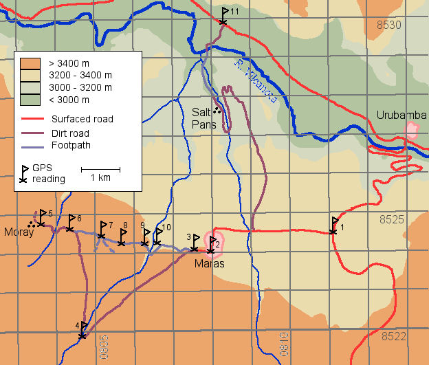
We climbed the zigzags from Urubamba and took the signposted turning to Maras (![]() 1
1![]() 2
2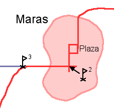 As you leave the town you come to a fork with a notice explaining that the righthand route is a bridlepath (camino de herradura) reaching Moray after 5 km and the lefthand route a vehicle road reaching the same destination in 9 km. We took the road. It makes a dogleg in order to cross the Q. Huayllaoro ravine high up.
There is an office of the Peruvian archeological organisation at the site (and lavatories). When we left we asked for directions to the bridlepath back to Maras, and it was pointed out to us. It forks left from the road at ![]() 6
6![]() 7
7
At ![]() 8
8![]() 9
9
The ravine at ![]() 10
10
Maras comes into sight soon after leaving the ravine.
For the salt pans, head back towards the Urubamba road and take the signposted dirt road to your left. This drops gently at first, and then gaily plummets, giving excellent views. At the saltpans it declines from road to footpath, and you will need to carry your bike some of the way down. You cross the Pichingoto bridge and join the main road.
We would not particularly recommend climbing from the Pichingoto bridge to Maras with a bicycle, but it has been done.
