| photos : gps tracks : ride stats
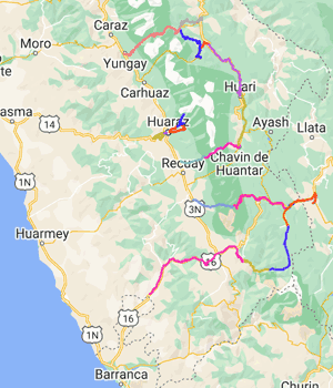 |
We hadn’t expected to find an Inca city; it is away from the usual tourist circuit and little known outside Peru. We were on a cycling tour of the southern end of the Cordillera Blanca and Huayhuash. Although less close to the snowy mountains than the usual Llanganuco–Olímpica circuit, this route takes you through wilder, emptier country, and the detour to Huánuco Pampa was a bonus. We had crossed the Llanganuco pass the previous week, ridden through the Conchucos with its Don-Bosco churches, and mountain-biked the Olleros–Chavín track, all of which were delightful.
Cycling over 4000m passes is never all that easy but can be made easier by asking Julio Olaza. Julio sorted out mule logistics for the Chavin ride, and arranged for Mauro to do the vehicle support for both circuits. To do the second route we needed to camp, and for this we had a cook, Elias. And they knew about Huánuco Pampa; we wouldn’t have found it otherwise.
We started from Pachacoto on the dirt road towards Pastoruri, and camped in a magnificent spot just below Huarapasca. At 4500m this was a rather high camp, and correspondingly cold, but right underneath snow fields and presenting a memorable starry night sky. On riding towards the Pastoruri glacier the next day, we found a new visitor centre with clean loos and also found that that bicycles are now banned beyond the car park. So we’d ridden to the altitude of Mont Blanc just to use a loo. As some form of compensation for not seeing the glacier, we saw a little family of vicunas on the way up to the Huarapasca pass.
Beyond the pass is a high bogland; we rode under icicles dripping from Cajap’s dark cliffs. It is impressively high country and we rode for ages not dropping below 4400m. It is a lonely area – we saw a solitary shepherd with 400 sheep. The road crests a ridge with a extensive panorama of the Cordillera’s snowy peaks but the weather had turned cold, windy and cloudy, and we were coming to the conclusion that this was no place to camp. Then we saw Mauro and Elias proudly showing off their gloriously located camp site, and the kitchen tent they had put up in the 300mph wind. We said, can we go to Huallanca, where it is 1000m lower and warm and there are buildings?
So we went to Huallanca which has an etymological park and marching bands of schoolchildren. It is warm(er). The next day we rolled further down the valley, a pleasant freewheel down tarmac, and sat in the park of La Union and read books for two hours, waiting for the road-workers’ lunch break before we were allowed up to Huánuco Pampa.
There had been dogs on the way. There are always dogs, everywhere. It is nice on rides to see farm animals close up: chickens, pigs, sheep, ducks, cows, mules – but there are also dogs. The locals keep dogs for good reason, to keep their animals safe from dangers such as gringos on bikes. You can hardly go past a house without eliciting a frenzied barking and snapping; in the middle of nowhere, a faint yap half a mile up a hillside turns into a long-range missile with a course programmed directly for you; the lazy mutt in the deepest depths of sleep instantly transforms into ferociously sharp teeth at your heels. Speed only spurs them on. Our aim with small stones improved remarkably over two weeks.
Back from Huallanca we made our way towards the Cuncush pass. It is a relatively new dirt road and in decent condition with a lot of mine roads sneaking off mysteriously. The valley is broad and pleasantly green with farms along the way. The weather played games – one moment sunny, the next dark with clouds, and in the strong winds neither alternative stayed round very long. The pass was grey and cold; we dropped into a very rocky valley and used the excuse of getting to somewhere warm to justify descending with maniacal speed. It’s an enjoyable ride in a strikingly deep valley.
The final two days held as much climbing as any previous day. Other gringos staying in Llamac said the road to Chiquián was not the sort of hill they would fancy cycling. We said, hills are ok, we are fine with hills, inwardly thinking oh dear. We descended 500m into the arid badlands of the high Pativilca valley, thinking oh dear, and slowly regained the 500m and 300m more, up to Chiquian – world famous for its cheese, cement works and insane zigzag road. On the final day the clouds vanished and we could see the mountains properly. We rode out on smooth new tarmac, climbing ever upwards on those zigzags with more and more of a view of Yerupajá’s steep snowfields. On this last day we only had a couple of 4000m passes to cross – after which it really was downhill all the way to the coast.
The page border is a detail from a fresco by Victor Delfin at secondhomeperu, a guesthouse in Lima.
GPS tracks
index : Cord. Negra : Horror descent : L. Llaca : chiquian : chucpin : conococha : cuncush : huachococha : huanuco pampa : huari : interoceania : llumpa new road : pastoruri : portachuelo : pupush : sacracancha : sanjuan : yanash1 : yanash2
| photos : gps tracks : ride stats